Fornacis, at the XI International Congress of the SEDPGYM
FORNACIS has been present at the XI International Congress of the SEDPGYM. Historic mining and metallurgy in southwestern Europe. Geology,
Home » Sitemap
FORNACIS has been present at the XI International Congress of the SEDPGYM. Historic mining and metallurgy in southwestern Europe. Geology,
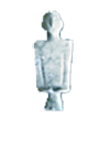
Recently, we have carried out in the Provincial Archaeological Museum of Badajoz (PAMB) the sampling of human bones from the
In the last days we have begun in the Provincial Archaeological Museum of Badajoz (PAMB) the archeometric characterization of the
3D Georadar Survey of the Hornachuelos-Fornacis oppidum has begun. This task is included within Objective A.1. “Definition of defenses, urbanism
Yesterday the planned drone flight took place in Hornachuelos to prepare a detailed topographic and photogrammetric plan of the oppidum

The oppidum of Fornacis in the historical context of Beturia
Archaeology and heritage of a landscape of the Roman conquest
Ministry of Science and Innovation
State Research Agency
Prehistory Area
Department of History